Saturday, 8 June 2019

Mile 535: Saint-Rose-du-Nord (Saguenay)


Saint-Rose-du-Nord (Saguenay)
Current Location: Saint-Rose-du-Nord
Date: June 8
Mile:  535
Locate:  Ramble On
Locate: Finnish Line 2.0


Looking down at our boats from wharf
Towns are the the fjord valleys
This stopover was a delightful one.   A small bay, easily missed if you don't keep an eye out.   A smattering of houses, and a wharf that hides a few floating docks.   The location appears to be a popular stopover for tourists.   A couple of restaurants by the wharf, a gift shop, but a steady stream of people, camper vans and bikers made this a busy little spot.

Waiting for the ferry to leave!
Our arrival created a little bit of a commotion.   A woman who spoke no english, but was clearly in charge of docking, greeted us and imparted that Ramble On couldn't be where we were because the ferry was about to arrive.  Finnish Line had chosen a finger that didn't have this complication.   So, we waited around the wharf until the ferry appeared from around the point, and we quickly cast off, circled, and returned to the spot once the ferry had exchanged it's passengers.   Turned out that our departure the next morning also overlapped with the ferry schedule, and we had to scramble off the dock to make space for the ferry a second time.

One of the few tradition lighthouses in the fjord
View from Cafe Rose
Some deeper investigation suggested we look for Chez Mina as "the" place to eat.   A short walk up the hill and we found the place, but we found it closed.   Debbie peered in the window to be sure, and she was greeted by the owner/inhabitant would indicated they weren't open yet. 

We ended up going to a very cute establishment right at the wharf called Cafe Rose.   This turned out to be a delightful place.  The owner, Georgette, was an animated woman who happily accommodated our attempts at speaking french and provided steady entertainment throughout our meal.  We enjoyed the experience and the food such that we ended up returning for breakfast the next morning.

Finnish Line look smart under sail!
While waiting and enjoying the wharf area Linda and I struck up a conversation with what turned out to the the proprietor of the local boulangerie.   After determining what time it in the morning, we showed up the next morning to bring back a selection of bread, croissants, and other delights!   all fresh that morning by, we think, the woman's son who, typical of a baker, had been there since midnight baking the days goods.

Tomorrow ... back to Baie Eternite to explore ashore this time!


Thursday, 6 June 2019

Mile 513: Chcoutimi (Saguenay)


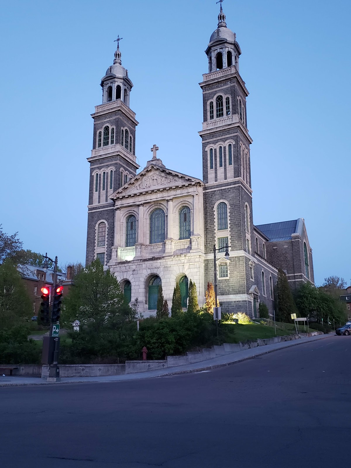
Chicoutimi (Saguenay)
Current Location: Club de Yacht de Chioutimi
Date: June 6
Mile:  513
Locate:  Ramble On
Locate: Finnish Line 2.0

We are currently as far north as Thunder Bay is. This isn't the furthest north we will get. When we are at the top of the Gaspé peninsula, then we will be as far north as lake Nipigon or almost as north as Whistler.

Travelling from La Baie, meant heading ENE, then turning back around cap-ouest, then back WNW.  We put up sail and had a nice wind that built steadily from a light off-wind leg, to some nice upwind sailing.   Once we were about 8 nm from Chicoutimi, the Fjord becomes a river and the river becomes very narrow.   We dropped sail, and had to pay close attention to the buoyed channel as being outside the channel had single digit depths in most places (or at least would have at low tide).

While we didn't see any evidence of shipping or commercial traffic in this section of the river the navigation was assisted by a number of range lights and beacons.  The final approach to the town was guided by a sector light.  This is in addition to the continuous pairs of red/greens marking our path.  Notably, this narrowing stretch of river presented increasingly strong current against us.   This is from Lac Saint-Jean about 30nm WNW from Chicoutimi.


Our destination, Club de Yacht de Chicoutimi, was the only place in town to bring your boat.  Primarily a motorboat club (which is probably due to the distance and current strength from sailable waters).


maybe 3 knots?
Our arrival at the dock was a little tricky as the water was rushing and surging along the dock, at times at 3 knots.  The current was primarily parallel to the dock, but every few minutes, a large eddy would swirl by the dock, and rush underneath, through between the floats and surge out the other side (where our boats were).

Our departure was also unique!   It has been on my list to add some air to all my fenders. Because of the cool weather they were all a little under inflated.  Well, that task caught up to us upon departure.   After a fuel up and pump out, we returned to the dock (as pictured above) to wait for Finnish Line to do the same.   With the current we were pegged to the dock, fenders compressed to almost nothing.  The dock hand helped push us off as we motored into the current, but rather abruptly we came to a complete stop.  I was on deck and couldn't see the cause of this until jumping back onto the dock.   Turns out that one of our "under inflated" fenders had hooked into one of the dock cleats, been completed pierced and then fully snagged.   It was not going to give up its hold on the cleat until we backed up a bit to free it up.   Add "fender" to the list of boat bit to buy when we get to Rimouski.


You can see the current in the water
Docking involved approaching the dock parallel, matching the current speed, and then crabbing sideways until the dock hand caught our lines.   We needed to keep it in gear and driving forward until the lines were well secured.  From then on, particularly on the ebb tide,  our boats would surge at the dock, making their own bow wave.   If you play the wheel you could steer you boat at the dock.  When inside the boat, there was the sound of continuous water past the boat.  Very weird.   They probably get very little growth on the bottoms of their boats.


Anyway,  Chicoutimi is where John and Nanci depart, and Debbie joins out little expedition.    John and Nanci take a bus back to Quebec City to enjoy a few more days off.   Debbie joins Finnish Line until Gaspé.

We spent a lay day in Chicoutimi.   The internet connection at the club was close to non-existance, hence this post being a little late.  We did some provisioning in preparation for the next legs and also enjoyed some dinners on the town.  Both restaurants were good, but in a sign of age setting in, they were way too loud.

Wednesday, 5 June 2019

Mile 489: La Baie (Saguenay)


La Baie (Saguenay)
Current Location: La Baie
Date: June 5
Mile:  489
Locate:  1) Ramble On, 2) Ramble On
Locate:  1) Finnish Line 2.0, 2) Finnish Line 2.0

We woke up to a glassy calm morning.  The water was like a mirror for much of the day and once the light cloud and fog burned off, we had warming sun too (certainly needed after a very cool night)

Seal casting a suspicious eye at us

Our departure activities were monitored disapprovingly from a distance by a local harbour seal.   We could infer his or her breakfast activities from the frenzied fish activity at the surface.  


Rorshach test (water like a mirror)
We motored toward our next destination hugging the shore so we could soak in the incredible scenery.  At time we were a boat length from shore, but still in 100's of feet of water.

Notra-Dame-du-Saguenay

Baie Eternite include a historical landmark.   In 1881, a 25' wooden statue of Our Lady of the Saguenay was transported up almost 600' to watch over the fjord and it's people.   There are hiking paths that allow you to go up for a closer look.

Watching our depth sounder blink "too deep to read"


As we approached La Baie (also know as La Baie de Ha! Ha!) we saw the wind pick up, on the nose again.  Two freighter cam into view, and we tried to make sense of our cruising guides, electronic charts in order to find our destination for the night.   


Not all trees find a suitable location
to put down roots.


We ended up and the city dock which is located behind a new multi-million dollar facility for cruise ships ... the really big kind. 

Not only were the docks top notch, the city had clearly been invested in to make it attractive to the 1000's of passengers would unload at this spot.


Tuesday, 4 June 2019

Mile 464: Baie Eternite (Saguenay)


Baie Eternite (Saguenay)
Current Location: Baie Eternite
Date: June 4
Mile:  464
Locate:  1) Ramble On, 2) Ramble On
Locate:  1) Finnish Line 2.0, 2) Finnish Line 2.0


Sheer cliffs everywhere
A short but blustery day today for our 9 nm "from here to Éternité", the final destination was well worth it!

There are few protected anchorages to be found along the Saguenay, but Baie Éternité is one of them.  We were hoping for some mooring balls but found none.  As everywhere here, you are in hundreds of feet of water until right against the shoreline.   Baie Éternité is about 1 nm long and counts as one of very few bays (Anse) on the whole river.

The location is a river valley that is right down and sea level, and the river delta is flat and sandy (at low tide).    Finnish Line dropped anchor in shallow water (where the mooring balls were indicated on the chart), but as they backed out to sent their anchor, quickly had depth readings over 100 feet.


John & Nanci exploring

Heading into Éternité!
John and Nanci ventured ashore in the dinghy to explore.  Baie Éternité is part of the Saguenay Fjords National Park and there was a Parc centre at the end of the bay complete with an interpretive centre, docks for dinghies, trails, suspension bridge, and more.   The rest of us may stop in there on our return down the river to explore for ourselves.


Again, as with most of the facilities on our trip so far, this Parc centre was in the process of opening and getting things setup and put together.  The next morning, they had already assembled their dock.   Perhaps there will be mooring balls on our return.


River mouth at low tide
As we settled at anchor in the afternoon, the wind calmed and then we were surprised with a few sudden gusts through the valley of perhaps 20 knots.   As night fell, everything was calm and still for the whole night.   (btw.   it was super cold and we awoke to 9 degrees in the cabin in the morning!!!)

Mile 455: l'Anse-Saint-Jean (Saguenay)


l'Anse-Saint-Jean (Saguenay River)
Current Location: Club Natique l'Anse-Saint-Jean
Date: June 3
Mile:  455
Locate (No tracking at location):  1) Ramble On, 2) Ramble On
Locate (No tracking at location):  1) Finnish Line 2.0, 2) Finnish Line 2.0

Cape Salmon lightouse peering out of the mist
We left Cap a l'agile at 6:30am this morning to catch favourable tides to enter the Saguenay.  We were greeting to a damp, cool and foggy morning.

We rode the tidal currents nicely until the entrance to the Saguenay.  We second guessed ourselves a little as we thought we were going to get there a little before slack tide, and we slowed down a little, but didn't properly account for the outflow from the river that was still underway.   In the end, it made little difference and we entered with no issue at all.

Baby beluga ... in the deep blue sea ..
Again this morning we were greeted by the local sea life.  More belugas, and this time a baby beluga right at the boat.  Harbour seals too ... looking at us pass by with either surprise or disdain. 


This is a picture looking back at Finnish Line coming into the Saguenay.  In the background are the Prince Shoal lighthouse, a entrance mark, and the largest freighter we've seen so far.  Packed with containers and about 900 feet long.


Today we had stowaways.   I think they were blue warblers (the female has this greenish/yellow belly colouring).  At times there were 4 on board.  In the end one stayed with us until near the end of our trip today.  She spent much of the time napping under our dodger or on the cockpit floor.    At times requiring a gentile pickup and re-location to a safer spot so as to avoid being stepped on.  The bird seem'd not to care less about our presence or activities.  She spent time in the cabin, dodger, under the cockpit floor grate, and anywhere else dead insects accumulated (Kingston midges!)

One freighter followed us into the fjord
The Saguenay is an imposing piece of geography.  Water depths of 900 feet and cliff faces of similar heights.

Water falls of hundreds of feet everywhere.  It's easy to feel dwarfed in such a place. Other than a freighter, and a traditional gaff rigged yawl, and some tourist boats, we had the river to ourselves.

The terrain is so rugged that there are few signs of in-habitation until we reached out destination for the night.

Too many waterfall to count


Both boats had crew on the foredeck to both to soak in the scenery and also to keep a close watch for logs, branches and other debris that gets churned up by the regular tides.


The weather today was cooler again.  This morning was very chilly requiring all sort of layers.  Especially due to the mist and fog.  Even in the afternoon, with some sun, we had to keep warm as the water temperature has dropped from ~14C down to 6C.  This means when the sun hid behind a cloud, air temperatures quickly approach the water temperatures.


The crew of both boats enjoyed the day immensely and were happy to be able to share this all with John and Nanci for their anniversary!

Saturday, 1 June 2019

Mile 394: Cap-a-l'agile


Cap-a-l'agile
Current Location: Port de Refuge Cap-a-l'agile
Date: June 1
Mile:  394
Locate:  1) Ramble On, 2) Ramble On
Locate:  1) Finnish Line 2.0, 2) Finnish Line 2.0

Early morning departure from Ile-d'Orleans
Leaving Club Nautique de l'Ile Bacchus 
Still winds and clear skies for our 5:30am departure.  Much discussion about tides, currents and departure time lead up to this point. 

All of the guides had stern warnings about where NOT to be when the tide turns.
Narrow point in the shipping channel


The shipping channel goes south of Ile-d'Orleans then back to the north side of the river through some islands.  At times it is quite narrow before opening up with wider channels.

Final remnants on snow!


The geography here is quite different with the Laurentians starting to show on the north side of the river.  Large cliffs are common along with ski hills and some very dramatic  views.  At times, no sign of humans and at others, houses an villages scattered along the hillside or on the shore.  Certainly some of the best scenery so far, and a beautiful day to enjoy it with.


Do the math!!!  = 7
Red arrows = 7 knots
Our route would take us on the narrower north side of Isle-aux-Coudre.  This would let us catch a bump in the current from the ebb tide that would shoot us around the island and back out into the river.   As you can see from the current chart, the speed varies widely at different points in the river so planning where you will be as the tide evolves is very important.   We pulled into harbour for the day just as the tide was turning, and crabbed into the entrance with a 2 knot flood tide just starting to pick up steam.

Isle-aux-Courdre boat yard
Tidal rip in otherwise calm water
We also experience our first tidal rips of any significance.   When two tidal flows pass each other without truly mixing, you get distinct lines of surface turbulence in the water accompanied by debris and foam.  And as we found out, it pays to be on the right side of the rip as it can make a couple of knots difference in your speed!

Whales!

By far, the biggest excitement of this leg was when John called on the radio to tell us he sees whales in the distance.   Like excited school children, we all located our cameras and got up on deck to see.  
Pod in the distance
With what would have surely been lost in the white caps had there been more wind, was a pod of belugas in the distance.   In the end we were treated to at least two pods of whales that went right by both our boats.   

They don't show their tails often
Right in front of the boat
As one pair approached, we let the boat slow, and a pair surfaced just in front of the boat, only to disappear and reappear at our stern.  We've got hundreds of pictures of white splotches in the water as their time at the surface is about equal to our reaction time to take a picture.  Our hope is that the Saguenay will have even more to offer.  


Leak in my muffler
For Ramble On, today was also the day of discovering of where the one remaining leak was coming from.  I had done a bunch of potable water plumbing this spring, and sorted out the minor drips that resulted, but we still had one bothersome water puddle that I couldn't quite identify the source of until today.   It only appeared while underway.

After narrowing down and eliminating the other possible sources, it turned out to be the water-lift muffler.   I was hopeful it was the totally inaccessible drain plug, I puller the muffler off once at dock, and quickly determined that it was not the drain plug, but the whole bottom of the muffler was cracked, and full of pin hole leaks.

The picture shows the bottom of the muffler were I had cleaned, sanded and gouged out the cracks.  Fortunately, it's made of fiberglass, and also fortunately, I brought along a West System epoxy repair kit.

The damage looked quite old, and the manufacturer claims this type of problem is almost entirely due to overheating (lack of cooling water through the exhaust). In either case, a couple of layers of glass and epoxy should keep us in business until we can source a new one.   After 30 years, it looks like they are still available, perhaps from West Marine.  

That's it for today's report.  We are spending a day in port today to avoid the rain and winds and buy us an extra hour later in departure time tomorrow (6:30am) for our next leg to get us into the Saguenay.   The entrance to the Saguenay must be timed carefully as the tidal flows and rips can be very tricky (understatement).