Friday, 16 August 2019

Mile 1670-1848: South-Western Shore of Nova Scotia


Southwestern Shore of Nova Scotia
Current Location: Shelburne Harbour Yacht Club
Date: August 5 to 21
Mile:  1670-1848
Locate: Ramble On
Locate: Finnish Line 2.0
Google Photo Albums: Sambro, St Margarets Bay - Schooner Cove, St Margarets Bay - South-West Cove, Chester, Mahone Bay Town, Lunenburg, LaHave, Mouton Island, Shelburne,


The next leg our our journey takes us down the Southwestern shore of Nova Scotia.  Between Halifax and Yarmouth, the shoreline continues to be both rugged and beautiful, but there are more large bays and inlets in this stretch of shoreline which provides more ports and places to explore. 

The destinations along this stretch are some of the more well know and iconic places in Nova Scotia:  Peggy's Cove, Mahone Bay, Chester, Lunenburg, LaHave, Shelburne and Yarmouth. 

This leg ends with our navigation around Cape Sable, across the Bay of Fundy and ending up in Maine USA.


Sambro Harbour

Sambro Lighthouse
First stop out of Halifax was in Sambro Harbour.  As we left the weather was pleasant and sunny, but then became breezy as we rounded Sambro Point.  The name Sambro, at least to mariners, may bring to mind the Sambro Island Light.  First built in 1758, and which now ranks as the oldest lighthouse in north america.  Apparently there are still rusty canons lying on shore from when they were fired regularly as fog signals.  We didn't head the extra 1.5 miles to see it up close, but given it's height we were still able to see it well as we rounded the point.

Someone is enjoying
a nice sail!
We continues around Sambro point and turned back north to head into Sambro Harbour where we planned to find an anchorage for the night.  The harbour area was quite protected and we found further protection in behind Powers Island which is nestled deep in the harbour. 

Our anchorage was pretty good, and certainly protected, but lots of motor boat traffic made it a little choppy.  It turned out we were right on a main traffic route to small lake past some narrows that were just out of sight. 

Small locally built schooner
We (Bob) had dropped anchor not too far from a nearby mooring ball which was empty at the time we arrived.   A while later, a cute little Lunenburg style schooner returned to this mooring beside us.  It had a 1 lung motor and put-putted to their ball in the very light wind.

Sunny day?  No better time for a sou'wester
The two guys on the were almost too stereotypical to be true.   The captain was a large fellow wearing what looked like a half-slicker and was also wearing a black sou'wester.  He mostly remained in the cockpit while his sailing buddy ran around picking up the ball and sorting other things our on the boat.   Note that the weather what day didn't really necessitate any foul weather gear, but it certainly made a great sight.


St Margarets Bay (Schooner Cove)


Brightly painted houses of Peggy's Cove
We cut close to the point
Next morning we pulled up anchor and headed out of the bay to and down the coast to St. Margarets Bay.

This would take us by the famous Peggy's Cove.  I've been there before, almost 30 years ago, and it was an overcrowded tourist stop then, and it's even more so now.  We were able to take a very close pass by on the inside of "Halibut Rock", barely a hundred feet from the shore.

Nothing like some peaceful quiet time
looking at the ocean .... not!
We could see 100's of people standing around taking in the little lighthouse on the barren but smooth rock point.   The little town of Peggy's Cove is just around the corner.  Tempted as we were to motor into the rock sided harbour, we thought better of it as the charts had no detail inside the harbour and the local fishing boats generally draw less than we do.

From there we continued another 10-12 miles deep into St. Margarets Bay into an area that didn't have the common fishing harbour look to it.  We could have been in the Muskoka Lakes from the look and style of the houses.  Well appointed houses, many with 30-45' sailboats moored at expensive looking wharfs and floating docks.   Obviously a playground for the wealthy around here.

Upscale homes
We poked ever deeper into a place called Schooner Cover.   The protecting at this anchorage was complete.   Aside from a road just beyond side behind the trees at the head of the cove, it was very peaceful and we were treated to a nice sunset.


St Margarets Bay (South-West Cove)


They are following us ... I know it
We left at 10:30am for leisurely motor to our next anchorage on the other side (West side) of St Margarets Bay.  Our passage across the bay was uneventful.   There was a Coast Guard ship anchored in the bay (we still suspect they are following us on our trip)

The anchorage is easy to miss as it's hidden behind Horse Island (we renamed it dead-tree island for it's entire tree population was dead) and another island (perhaps not a true island as there was a causeway wide enough for a car to cross) .  In fact, once we had anchored, another boater poked their way into the anchorage just because they saw us tucked in there and didn't realize it existed after have sailed this area all his life. 


Tight anchorage for sure!
Every tree is dead?
The anchorage was particularly small and narrow.   A small boat/yacht club had about 5 mooring balls here but they were all full so we made do with anchoring.  It was a tricky spot to anchor trying to avoid a few shoals and the shore in this narrow space (< 400 feet wide). 


Worst ... looking ... castle  .... ever


Built at the head of the little anchorage was the most abysmal example of Germanic castle architecture.  Hard to explain how awkward it looks.


Seals basked and fed all
afternoon and evening on the shoals
We spent the afternoon relaxing on the boats, and watching seals feeding over rocky/shallow areas.  As we had seen before, they sometime spend their time swimming on their backs with the eyes in the water, perhaps to see the fish below.  There were probably 3 of them that spent the whole afternoon and evening fishing or relaxing around this shoal.

The night was a little lumpy as the ocean swells diffracted around the point so they were perpendicular to the wind (and boats) and made for a somewhat awkward motion between the rafted boats.


Chester

Not your traditional maritime house
Chester is well know in Canadian sailing circles, and perhaps beyond, as they host the famous "Chester Race Week".   Located in Mahone Bay, Chester is short 15 nm from our anchorage behind Horse Islands.   Chester is located centrally in the bay, and behind the Tancook Islands and also behind some smaller islands located just in front of the harbour.  This provides a good amount a shelter from the Atlantic swells and fetch from the south. 

However, our short sail was quite lumpy until we gained protection from the Tancook Islands where the wind also faded with the swells.

Chester Y.C. is a pretty small affair
Chester Yacht Club is a small affair and the member boats are all at mooring balls.   Thus, the dinghy dock was quite a congested affair.

We anchored in the "back harbour", which is just to the west of "The Peninsula".  The Peninsula is connected to the mainland via a short causeway that also includes a bridge where dinghies can get under! (the Dinghy Canal)  Handy for easy access to the club and the town (though at times the current under the bridge was quite strong).

Chester is very picturesque, but bears little resemblance to the many other sea side towns we have been in.   There is no fishing harbour here and the houses really show the wealth that this area has a reputation for.

There are only a few places to eat in town, and we first ended up at the Fo'c'sol which had been recommended to us at an earlier stop.  After dinner we reset anchor so as not to be quite as much in the anchorage entrance channel as we initially where. 

We went to bed to an evening shower that would hopefully remove some of the pesky salt buildup from the topsides.

The next day we stayed in Chester to enjoy some local theater and poke around the town a little more.  We made a trip to marine store which was  more like marine "closet".  The bare minimum of anything here!

We ended our day with dinner as the White Gate, which was excellent, and followed it up with our night at the local theater to see "God is Scottish Drag Queen".   It was really just a one made stand up routine where the guy was ... you guessed it ... God .... and a Scottish Drag Queen.   It was a funny show and he covered all sorts of otherwise taboo religious topics, but the Scottish Drag Queen part opened the door to just about any other topic.


Mahone Bay Town

Emerging from a fog bank
The common theme for this stretch of coastline is Fog.  Leaving Chester was somewhere between pea soup and milky fog (I don't quite know which of those two is worse) until we got to Indian Point (on the final approaches to Mahone Bay Town).  The fog lifted at that point and we got to enjoy some of the scenery and we approached.

Mahone Bay Town is tucked into the SW corner of Mahone Bay and was only a short 10 nm hop.  The harbour is deep and very well protected.  No swells could make it in here past the handful of islands and into this deep harbour.   We stayed and the town dock which has nice enough showers and washrooms as well as pump-out facilities.

Town dinghy dock (we're docked at the end of the wharf)
Once we got settled and payed the dock attendant (an amusing affair as we watched the attendant feed receipt sized pieces of paper into a 8.5x11 printer with only occasional success)  we went to stroll the town.  Not particularly big, but a good handful of shops.  The homes along the main street around the bay were ornate beyond what most NS harbours would even hope for.   This was originally a shipbuilding town, and perhaps there was some affluence back in the day.   These houses were striking and many were very well maintained.

Upon arriving in the harbour we began hearing the piercing sound of an Osprey nearby.  Once we were tied up we noticed one sitting on the masthead of a boat at a mooring ball.   The owners were shaking their rig to get it to fly away, eventually with success.  We didn't think to much more about it except "poor boat owner".  The bird actually spent some time on a few different mastheads in the harbour.

Very ornate historic homes
Well ... as we returned from looking about the town and as we were walking towards the docks and boats, I watched an Osprey land on my masthead, and more specifically on my brand new electronic instruments.   At this point I  started running like a mad-man to the boat, and gesticulating and yelling at the stupid bird, but it didn't move.  I quickly went below and returned with an air-horn, and fired that upward toward the masthead to no effect.   Finally I just grabbed the shrouds and shook hard, and it finally got the hint.   Of course it just flew 40 feet away to Finnish Line's mast head.   Bob was still back at the marine office, so I hopped on his boat, and shook his rigging until it departed.

There were a pair of them landing on various masthead around the harbour all evening.   Aside from the possibility of wrecking my brand new $500 instruments, it was a very bizarre sight to see such a large bird sitting on the Windex of boats, and gently spinning in circles.    A survey of the 30 some odd sailboats in the harbour show'd many with missing or damages windex's or electronic instruments.

Debbie's brother Bill and his wife Leslie dropped by for a visit and brought Bill's daughter and granddaughter as well as Curtis (who we had met back in Halifax).  We enjoyed some growlers of Propeller provided by our guests and and other tasty snacks.

For dinner, we went to "Oh my Cod", and had some excellent fish, clams, etc.   Happened to be talking "Navionics" (charting software used on boats and also an app on smartphones) between the group of us and that caught the owners ear.   He asked were we were from and said Kingston, and then he said he was from Hamilton.   We said "we came by boat" and he said "so did I!"  Turns out he and his wife quit their jobs last year, and planned to sail to the Caribbean.   They got to Mahone Bay, and saw a restaurant for sale, and decided to stay.  This type of story is one we have heard and continued to hear all along this coastline.   It's beautiful around here and people fall in love with it.


Lunenburg

The town is built on a hill overlooking the bay
In Lunenburg our only dock option was a wharf owned by Zwicker & Co. in the slightly remote part of harbour. It suited us perfectly as it was nice and quiet at night, yet only a short walk to downtown. The plus was being next to a working shipyard! Zwicker & Co offered good services, free showers and free laundry!, although a 10 minute walk from our wharf.   The main downtown wharf was undergoing some re-construction so our location may have been better in the long run.

The shipyard next door was where the latest "re-build" of the Bluenose II was relaunched after some initial "problems".

Our first day in Lunenburg was filled with the usual chores of laundry and heading to the marine store to sort out some minor boat needs.

With a busy harbour comes the wake from passing boats. We were stern-to most of them, which causes a slapping on the hull that resonates in the aft berth. Not a fantastic recipe for sleeping! However, Bob and I  perfected the "anti-slap" contraption for the transom! It's basically a pool noodle lashed just under the edge of the transom that acts as a wave dampener. It worked well!

Traditional boats everywhere


Lunenburg, with UNESCO heritage designation, is such a pretty town. The houses are all well maintained and still have their original wooden decorative features. Apparently, homes sided with vinyl have been grandfathered, but if if they want to re-clad, it must be with cedar. Each home seems to be unique in design and colour (the bright multi colour nature of the town is apparently a modern addition).

Lunenburg "bump"
The architecture here is quite unique.   The steep geography right along the shoreline of the harbour allows each street parallel to the water front to appear stacked about the next allowing many of the houses to be visible as you approach the harbour.

Many of the houses are quite fancy in a uniquely Lunenburg way.   Scottish dormers at very common here.   The are comprised of 5 sides (3 of which have windows) instead of the typical 3 sided dormers.   Further, you take a Scottish dormer on the second floor slightly extended out over the front entrance and extended the lines down to ground level and you get the Lunenburg "bump".

Double "bump"
These "bumps" have a striking similarity to the houses on Ile d'Orleans with the projection/tower over the front entrance.  They didn't have the Scottish 5 sided style, but the "bump" concept is mirrored.

The tourism is booming here and there were plenty of good restaurants. The best ones were busy and hard to get into, but we had some very fine meals at Salt Shaker Deli, Beach Pea Kitchen and The Half Shell Oysters & Seafood. At the latter, we had seating on the patio overlooking the bay, and we were treated to a fantastic golden sunset as we dined.

Theresa E. Connor, similar to the Bluenose II
We did a tour of the Marine Museum along the waterfront.  It's quite expansive and fills a couple of large old warehouse building along the wharf.   As part of the museum, there are a number of boats moored that can be toured as well.  The Bluenose II is away on the Great Lakes, but they still have a similar wooden fishing schooner that is more or less preserved the way is was when they stopped using it.  There is also a large steel fishing trawler where local retired fishermen give tours.

On Tuesday, Linda and Debbie got themselves ready to catch a lunchtime concert at St. John's Anglican Church, one of Lunenburg's impressive old churches. Unfortunately, the concerts are held on Wednesdays. Oops! So, instead they grabbed a fantastic lunch at Laughing Whale Coffee "Shop on the Corner" and then went on a horse-drawn city tour. The young lady driving was excellent and the horses are well cared for. I think it was one of the highlights of Lunenburg for Linda.

??


A bonus of our location was the proximity to the grocery store a few steps away (uphill). The afternoon before departure, we picked up a few items for the next few days and filled our water tanks. The next morning there was a bit of fog, but it cleared quickly and we set off to the most amazing bakery on the south shore!


LaHave


The "Ovens"
It was a very short out and then back into the next harbour over.  Upon leaving Lunenburg, we passed the "Ovens", a unique cave formation on the west side of the bay.  While short, we did see a Minke whale in transit.  Finnish Line spotted dolphins too!.   It is always a highlight to see the sea life that we are so unfamiliar with in the Great Lakes.   This was LaHave.  We had found that for a modest fee we could moor at the bakery wharf/dock if we went in to shop!   That was something we couldn't turn down.

First we continued down the harbour to the  LaHave River Y.C to fill up on fuel.  Once complete, we headed back to the bakery and found our spot on the wharf.

"The Bakery" - local sailing school stopping for snacks?
The building that now housed the bakery used to be a marine outfitting operation back in the days of sail and the building is remarkably well preserved.   There is a bakery, a bookstore and a craft shop in the building.  The bakery is really a cafe that also has baked goods.   The Cafe still has the safe and office, completely preserved and old books and ledgers are still in the drawers to look at.  Before we departed we added some baked goods to our pantry.


Thick fog in the morning


We woke up to a peaceful morning but again fog so thick you couldn't see 100 feet. We went back into the Cafe for breakfast before heading out into the mist to head for an intermediate anchorage before we get to Shelburne.


Mouton Island Anchorage

Sometimes this was all we saw of Finnish Line

We departed LaHave in fog, and spent most of the day in fog.  It cleared for a short while as we approached Port Mouton Island, but quickly filled in again and stuck with us until the next morning.

This meant navigating around behind Port Mouton Island by charts only (electronic).   Lots of shallows here and we took care to be sure we were following the charts carefully.


Apparently "Mouton" originated
from when a guy named Pierre Dugua (French explorer) lost a sheep overboard nearby in 1604.


We awoke to dew and fog and very wet boats!!!


Shelburne

We departed our anchorage in fog, and again, had fog all the way to Shelburne until the final approaches (near land)  where the fog lifted sometimes.  Shelburne is quite deep down the Roseway River bay and as is often the case, the fog lifts once surrounded by that much land.  This was a nice break from a day otherwise without anything interesting to look at (though you are always keeping your eyes peeled for unexpected fishing boats).

Fish farms
Heading up the river we passed a number of places were there were fish hatcheries or some other aquaculture operation.  There were about 5 floating cage structures, anchored and separated by about 30' and at the end was a weird looking boat that seemed to be feeding each of the cage contraptions with big hoses.  Maybe something to do with feeding or water circulation?

Irving Shipyard busy at work
On the way in we passed one of the Irving shipyards.   There was a small camouflaged navy boat there being worked on as we passed by.


Temporary Clubhouse at SHYC
We had slips booked at the Shelburne Harbour Y.C. and we ended up on the outer face dock.   While exposed to harbour traffic, the location was still reasonably protected.   Upon checking in we were told that there were no facilities (washroom, showers, etc.) in the clubhouse as they had had a fire in the spring.  Their  summer clubhouse was a mobile trailer/office with a make shift patio with tents over-top.  They had a limited bar, but not much else.  Washroom were in porta-potties and showers where in a building a couple of hundred yards away in the "Sailing" building.  None of this was a major inconvenience.

An ongoing discussion at this point was planning our crossing to Maine.   Now we are a pretty cautious bunch and stick pretty close to the advice we find about how to time the tides and departures, and manage the currents.   This issue we have for this crossing is that there is a handful of good information, but it's not all consistent and sometimes seems to be in conflict. 

The major factor to keep in mind is that Cape Sable can have very nasty current effects.   The charts are littered with "overfalls", "tidal rips", and other such scary sounding things.   Local sailors noted that the overfalls can easily look like breaking waves on a shoal, but in fact may have 50' of depth below them.  So, to avoid these conditions we wanted to be there in slack tide.   And slack low tide has some further benefits (if you ignore the fact that you get sucked into the bay of Fundy by a non-trivial amount.

Cooper saw?
The other major factor was to find a weather window that minimized the chances of strong winds.  Aside from dealing with strong winds on their own, if you add winds and opposing currents you start to get sea states that become quite chaotic.

Over the next few days we continued to monitor weather and do as much research as possible to ensure we have a safe and enjoyable passage to Maine.  We also found time to explore the town and it's history.

Dory partially constructed
There is a Museum that carries on the tradition of building traditional dory's, the kind of which would have been on the decks of the Bluenose and all the other fishing schooners of the day.   They are both sturdy work boats, and have a number of unique features such as removable seats for stack-ability.  The shop makes about 2 per season, but they can be commissioned to build one for you if you like!

The town had a number of other historic houses and of particular note was the Ross Thomson House.  An interpreter/guide took us on the most informative tour of this interesting house.   The house combined a storefront on one side and the living quarters on the other.   The store would have sold things like molasses, tobacco, candles and coils of hemp rope.    It was built in 1787 and is almost perfectly preserved due to the fact that for the better part of the 1900's it was sealed up the way the last resident had left it.

It's Hurdy Gurdy time!
We actually returned to the museum house grounds the next day to listen to music in their garden.   A number of local musicians joined in.  It was partially to reproduce music as we might have heard in the 1700's, but also a venue for these musicians to sort of jam and play some of their own songs as well as a few song that we might have hear 100-200 years ago.


Ships Saw
(missing top wheel)
Workshop still powered by belts and pullys
We also passed a lumber mill that looked like the day it would have stopped running almost 100 years ago.   We peeked in a door that was ajar and saw a labyrinth of axles, pulley's and 1800's belt driven machinery and as if it was last used yesterday.  Outside the building under an overhang was an enormous "Ships Saw".  These are large band-saws that are unique to the shipbuilding trade.  They allow you to cut progressive bevels on the edge of ships hull planking.   With the saw was a small cart on rails to allow the large and very heavy timbers to be fed into the saw.   This aspect caught my attention because I have been watching a couple of Youtube channels about wooden boat building and these young folks are building boats the traditional way, and both have sourced old Ships Saws to make their projects possible (Acorn to Arabella, and Sampson Boat Co). 

The rest of our time we continued to poke around the town, made our way to Sobeys to stock up at our last chance to buy Canadian foods!   Tomorrow we depart mid morning to cross over to Maine and begin our next leg exploring US east coat down to New York City.  This is our last Canadian stop until we touch foot back in Kingston!


Monday, 5 August 2019

Mile 1651: Halifax


Halifax
Current Location: Armdale Yacht Club
Date: August 1 to 4
Mile:  1651
Locate: Ramble On
Locate: Finnish Line 2.0
Google Photo Albums: Halifax

Arriving in Halifax is a significant point in out exploration of Nova Scotia.   We have just come off 5 days of mostly foggy traversal of the eastern shore, and this is certainly the biggest port/harbour we have been in since Montreal and Quebec City. The fog lifted as we entered and we had clear sailing down the "Northwest Arm" which is where most recreational boat are.   Ships and other deep draft boats go down the main channel between Halifax and Dartmouth (which continues on to Bedford Basin).
AYC clubhouse
once warden's residence (1808)

Linda had sailed here before. She and Debbie, who will meet us here and crew the next leg, raced Solings here in the Sail Canada 2003 Women's Keelboat Championships, hosted by Armdale Yacht Club. Great memories!


Day 1

Northwest Arm, a very busy place
We went all the way down the Northwest Arm to find our spot at the Armdale Yacht Club.  We passed the Royal Nova Scotia Yacht Squadron on our way there.   While both club have floating docks, they also both have extensive mooring fields while take up about half the width of the arm.  Armdale is closer to downtown (closer to The Binnacle.ca! too), and while it's not really walkable to downtown, it's a good bunch closer.


The temperature went from a cool 20C out in the fog to high 20s and very high humidity in the evening.   Once tied up and checked in, we made for the bar to get a cold beer and relax before a delicious dinner at the YC. Linda particularly enjoyed her pan-fried Haddock.

light show!
As the evening progressed, we kept an eye on a line of storm cells skirting north of Halifax.   We eventually did get some rain and were treated to a spectacular electrical storm that just passed over the north of the city.   There were many strikes and a few quite close to us.


Day 2

While some of us had been to Halifax before, we all wanted to take in the major museums and historic sites.  First on our list was the Immigration Museum.   This was located in building on Pier 21, which was one the major landing points for people arriving in Canada (others being Quebec, Montreal and St John).    This port operated until 1971 after which people arriving by ship was no longer a major factor in immigration.  About 1.5 million people arrived in Canada through pier 21, though the vast majority did not remain in Halifax or Nova Scotia.

While the museum walked you through what it would be like to be an immigrant, it also touched on the various forms of discrimination to which immigrants might be subjected.   This was a well put together museum and worth a visit if you are nearby.

"Bluenose" ... the smaller version
Lunch was had nearby at Tomavinos, which was immediately adjacent to the Garrison Brewing Company, who's beers we've been enjoying all through Nova Scotia (Tall Ship is really nice!)

While we found ourselves along the waterfront, we had to drop in to see the Marine Museum as well.  The exhibits were very good and covered topics such as Halifax Explosion the Bluenose (big and small) and many aspects of local and regional shipbuilding. I recommend this for any history or sailing buff.

Theodore - he's real!!!
As was yesterday, today was hot and humid, so after our museums, we found the the Black Bear ice cream stand and picked up something to cool off and enjoy.

We went to see a matinee showing of Once Upon a Time On Hollywood.   A little slow to get going, but yet another move driven by both music and an exacting re-creation of late 60's everything.   It very much felt true to the time period.  Pretty good movie too!

Following the movie, we had a few minutes to spare, and wouldn't you know it, Linda found a shoe store! It turns out they had an entire table of summer shoes on sale just her size (who does that!). It's a miracle she got out of there with only two pair.

We capped the evening off with a delicious dinner at La Frasca Cibi & Vini. Great pasta and seafood, and it was right across the street from the theater!

Day 3

Having a extra day or so in any one destination usually involves some provisioning, a load or two of laundry and we also decided to deal with some lesser boat issues.    The Binnacle was on our list of places to spend some time (read .. "money"). 

For me, I had been having some very erratic wind speed reading from my wind instrument.   It was dramatically under-reading wind speed.  It has also had a long standing problem that when you were using the VHF, the wind direction and speed would go all wacky.  I had tried changing some calibration settings, but I wasn't able to compensate for the discrepancy.   Anyway ... they had a new transducer in stock and they are compatible with the old wiring and masthead connector, so it should be a easy swap!

The other projects involved replacing some hoses and fittings for the vent and fill hosts for my forward fresh water tank.   The thru-hull fitting had been lose, and I has suspected I had a small leak there when we were in big seas.
Old prison building, now sailor's lockers

Armdale did not have onsite laundry facilities, but Linda discovered the Bluenose Laundry. They offer a wash and fold service for $11/load! When your dropping coins in machines and praying the dryer does its job in one cycle, $11 is a steal!!

Once we got back to the boat after provisions, I decided that that now would be as good a time as any to install the new wind transducer.   Poor Bob and Linda .... I'm not the lightest to be hauled up the mast.   It was a slow ascent (local sailors were cheering on Bob and Linda as they hoisted), but once at the top, I was able to exchange the old transducer for the new and have Bob and Linda check the instruments below to verify basic functionality (it would need calibration later).  I also gave  the windex a slight bend to straighten it out, though once back on deck, I don't think I improved the situation.   Very hard to get a good visual perspective from so close to it while at the masthead.

Later that evening, we enjoyed another dinner at the club. Debbie, her brother Bill and wife Leslie (who were kind enough to deliver our clean laundry) joined us afterwards on the clubhouse deck for drinks (they snuck in some locally-made rum cream drink to enjoy once the staff has left ... yum).

Day 4


A family friend of Linda's, Olga Smith, had moved to Halifax several years ago after her husband Gordon passed away. Linda was thrilled to be able to connect with her and the three of us went for lunch at the Tartan Tea House in Bedford. It was a new experience for all three of us. But the tea really was very good, as well as the sweets and mini sandwiches...and remarkably filling!

The Citadel
Today Bob and I went to the citadel while Linda went to listen to music in The Halifax Common: the African Nova Scotia Music Association Festival.   It was a hot day in Halifax and it's hard not to feel bad for the Citadel reenactors and other staff in their wool cloths and feather bonnet.  Always good to refresh your knowledge of Canadian history from other corners of the country.  Very good guides and informative displays.

Later we joined Linda and Debbie at her brother's place (not too far from the citadel). We were treated to a fantastic BBQ salmon dinner by Bill and Leslie in their beautiful, lush garden. Afterward walked to The Commons to continue listening to more of the African music festival.
McNabs Island, Halifax Harbour


Day 5

Today we depart Halifax to continue south-west along the shore of Nova Scotia.   This section of shoreline is about 120 nm long. Unlike the route from Cape Breton to Halifax, there are many harbours, historic towns, places to visit and explore.  Peggy's Cove, Chester, Mahone Bay, Lunenburg, Shelburne and more. 

After a handful of boat tasks to complete, we pushed off, direction Sambro Harbour.  A quick stop at the RNSYS to use their outrageously expensive (barely functioning) pump out facilities, and we were on our way.  BTW ... the most expensive pump out I've ever had.  Hopefully it stays that way.

Wednesday, 31 July 2019

Mile 1520-1666: Eastern Shore of Nova Scotia


Tor Bay to Halifax
Current Location: Armdale Yacht Club
Date: July 26 to August 1
Mile:  1520 - 1651
Locate: Ramble On
Locate: Finnish Line 2.0
Google Photo Albums: Tor Bay Hartlings Island Shelter Cove Jeddor Harbour


From our departure form the Bras d'Ore Lakes until we get to Halifax will require almost 200 nm of sailing with much of it along coastline that is rugged and has relatively few harbours for recreational boats.  In fact, we planned to anchor our each night until we reached Halifax.  Our final departure point from Nova Scotia will be Yarmouth or perhaps Clarks Harbour, and that will be almost 400 nm of sailing.


Large boulder inside Tor Bay
The conditions leaving St. Peter's were calm and favourable, but as we progressed through our 50 nm leg, the conditions became a little windier and the swells competed with the wind waves to create some very uncomfortable motion.   Once and a while we were punching our bow through waves.   Our first stop on this stretch would be Tor Bay.  A large bay well protected from the prevailing SW winds.


Tor Bay


Berry Head light and breaking swells

As we approached Tor Bay we began to get a reprieve from the swells as we gained protection from Berry Head.   We arrived a little while after Bob and he had already pulled right up to the south shore of the bay, just inside the point, and dropped anchor. We proceeded to pull up beside and raft. 


Nasty shoal!


The anchorage was flat calm, but you could still hear the breaking swells from the point and the other side of the head.  The ocean rarely sleeps even when the winds die.


Hartlings Island

Our next stopover on the eastern shore was another 50 nm away.  We have been scouring the charts and the ActiveCaptian resources along this shore to locate anchorages.   While there may be 1000's of places to hide out and drop an anchor but seeing a location marked with an anchorage or having a review confirming good holding gives you peace of mind.   The shores here are rocky, and unforgiving. 


Hard to see but ...
Tuna fin in lower right of picture
We were able to knock two more types of sea-life from our list this day.   At one point we passed a gently flopping dorsal fin at the surface very close to the boat.  It had the distinct ridged pattern that looked more like a tuna fin than anything else we could determine.  It remained at the surface and continued on behind us such that I gave Bob a call on the radio to give him a heads up.    After talking to him later, he said he hadn't actually seen it, but did feel a lurch or something on the boat that made him feel as if he might have hit it.

Later in the afternoon at two different times we saw sea turtles go past the boat.   They surface for just long enough for you to go and get your camera, but not long enough to get an actual picture of them.

Our destination was an anchorage tucked in behind Hartlings Island near Ecum Secum (competing for best place name we've found).

The anchorage was as described.   We were well protected from any ocean swell, and had limited fetch on all sides.   There was some tin boat traffic from local fishermen, and an abandoned cottage on the island, but otherwise it was just a seal or two to keep us company as well as a curious seagull that swam around just a few feet from the boats for quite a while perhaps hoping for a food scrap which we didn't provide.

In the morning, we awoke to varying thicknesses of fog, and as times we could barely see any of the land masses that surrounded us.  The fog often comes and goes, thins and thickens, sometimes you can see blue sky if you look up.   We decided to hold tight at this anchorage for another day to see if the fog would clear up for a morning departure the following day.

Morning fog behind Hartlings Island
By the time we awoke the next morning, we were still fog bound.  We decided to delay our departure a little to see if it was going to clear up a little.   Environment Canada does include references to fog on their marine forecasts but, as is their marine forecast in general, it's very terse and not always enlightening.

Eventually, while still hazy, we could see a comfortable mile or so in all directions, so we made the call to lift anchor and get ourselves underway.


Shelter Cover


Today provided a taste of what was to come along our journey along the south side of Nova Scotia. No sooner that had we gone a few miles, the fog filled back in and filled in thick.   It varied little all day except when, at times, you could see 200' ahead, but most of the time barely more than 100'.


Our destination for the night was an appropriately named place called Shelter Cove. Our route would take us through a minefield of shoals, rocks and tiny islands.

Landforms only barely visible
The approach I use to navigate through this stuff is approximately as follows.  The Navionics app (we all have this installed on our devices) provides an "auto-routing" feature that generally does a pretty good job at finding a reasonable path between two points.  It has a preference to buoyed channels, but it is also happy to wind you though other more obsecure routes as long as there is deep enough water.  After examination of the Navionics route, I manually enter my approximation of this into my Garmin chartplotter.  I can then adjust waypoints for preference or for better clearance around obstructions.

Most of the time we couldn't
see Finnish Line at all
Actually following the route is a combination of letting the auto pilot follow the track,  reverting to auto-pilot override, and occasionally manual steering.   There is no question, letting the auto-pilot steer in this kind of fog does a way better job that a human.   It usually keeps you withing 5' of the "pink line" and makes pretty snappy turns to each new waypoint.   There are no reference points in this kind of fog.  Steering by compass would result in small deviations in course as you wander and correct. 

All of this requires double checking routes and waypoints, and cross referencing the chart plotter charts with the Navionics charts to be sure they are in reasonable agreement.   You still need to do your homework and double check everything, at every zoom level!!! (remember Vestus)

Today there would be no sailing.  There wasn't much wind, but
Typical navigation between
shoals and islands
our course meant that sails would have been a additional distraction and would further reduce the chance of seeing another vessel cross our path or a rock or island we hadn't anticipated.  We had eyes peeled for boats (fishing boats typically don't have AIS) and ears listening for buoys, waves breaking on rock and other warning signs.

Finnish Line to windward
One thing we are very aware of is that marks are often not where they are charted.  Not a big problem in good visibility, but now a bigger concern because these marks would appear out of the fog, sometimes right where you expected them, and other times not.   Give the prevalence of fog along this shore, many of the outer mark have either bells or whistles.   The bell buoys are straight forward enough.  A large, 1' diameter bell with swinging gongs on the four sides.   The whistle buoys sound more like bullfrogs.   There is some sort of an air chamber and one way valves that trap air as the buoys sways and bobs in the swells.   The air is then forced through an organ style pipe that has an oddly low frequency.   Very effective as the sound travels long distances.

We crept our way into Shelter Cover.   The entrance was only 300' feet wide, and the length of the cove was probably not more than 800' long.  We had a few of these narrow channels to navigate today, so away from the wind and swell, this was no longer a navigational challenge.  Now if we had relied on paper or electronic charts alone we probably would not have entered this cove.   The charts all reported just a few feet of depth to get in.   One of the very helpful additions to the electronic charting products you have now is crowd sourced reviews.  We have relied on ActiveCapitan reviews for many of our anchorages and decision making on this trip.   There was a recent posting that the depth into Shelter over was 20+ feet and that the charts were not accurate.   We did proceed very slowly into the cove, but we didn't see less that about 22 feet.

Once our eyes had grown accustom to our surroundings, we could see we were not alone in the cove.  There was another sailboat deeper in and a couple of hundred feet away, and we could only see it half of the time.

Always checking you out ...
but rarely caring

While we never did see much of the cove, we did have the company of a young seal that spent lots of time swimming and fishing near us.  At one point I saw him playing with a fish he had caught by tossing it up in the air.


Jeddore Harbour (Myers Point)


Marks only become visible when
they're 100' away
Our last stop before getting to Halifax was Jeddore Harbour.  Charts suggested some anchorages deep in that should have been very protected.

Fresh off a few days of fog navigation, we didn't hesitate in departing in the fog from Shelter Cove.  We continued to exercise caution in route planning and navigation.  Again we were blessed with a day of complete fog that followed us until we were at the mouth of Jeddore Harbour were the shoreline, houses, and other features began to appear in a sunny haze.

This was the first real signing
of land for the whole day
We eventually ignored the recommended anchorage as it appears to be just at the edge of narrow channel and the harbour still had some fishing boat activity.  We continued further in, and followed a vary narrow channel (well buoyed) until we found ourselves much deeper in and there we found a well protected anchorage away from any potential traffic concerns.

Fog had lifted further in the harbour
Throughout the day, aside from what the charts were telling us, you could also use other senses.  You could often feel a temperature rise, or catch a whiff of bird shit as you passed to the lee of nearby islands that we knew were there but could not see.


Halifax

Now, throughout these fog bound legs, Bob was keeping his eyes on his radar.  A couple of times he radioed to let me know about things I couldn't see.   Many boats have AIS, but fishing boats, at least the smaller ones, do not, and other recreational boats may or may not have it.  Radar sees everything else.

At one point Bob was tracking a boat on radar that was approaching his course or position, so he altered speed and course to avoid.  Bob communicated this to us via VHF so we'd understand what his otherwise erratic course was all about.  Even with all his efforts, the other vessel still had concerns and eventually called out on the radio to "Finnish Line" and after a little communication the fishing boat said "Can't you see me, I'm right behind you!"  Bob looked over his shoulder to his aft to find a fishing boat hauling traps! 

leaving the fog behind and
turning to head into Halifax
Shortly after that, from what sounded like the same person, came an additional call to a "sailing vessel" at some specific long/lat.  Linda and I scrambled to sort out our exact position and determined it wasn't us.  Just a FYI, Standard Horizon remote mics always display the long/lat on the had unit for easy access.  So, what is the moral of these incidents ... well, around these parts radar is  very common and so it should be and I guess that while we were happily avoiding shoals and islands while navigating blind, there were probably a good number of other non-AIS boats milling about in the fog that might have been withing spitting distance.

Freighter disappearing into the fog
As we approached Halifax and started our turn north the fog progressively lifted.   Halifax is a busy port, so this came as no small relief.

We watched a freighter depart the harbour heading south west.   After they dropped their pilot back on the pilot boat, they carried on and disappeared into the fog.  Interestingly, the last thing we saw of the freighter was the bridge superstructure which was taller than the fog bank.   What a view the bridge crew would have from such a vantage point.


Minke whale in
Halifax harbour
Still an active commercial port
As we got further into the harbour approaches, my eye caught sight of a rather sleek looking 100+ foot ketch.  Linda picked up the camera and took some photos.   Only later, while reviewing and doing some photo editing did we see that a whale had photo-bombed the picture.   It is probably a minke whale, but could be a fin whale as well as they have a similar profile on their dorsal fin.  Turns out a couple of minke whale had died in the Halifax harbour area in the last couple of months.  One wonders if this might be a remnant of that pod.

Old WWII fortification?
R.N.S.Y.S.  (we left them a deposit
when we left Halifax!)
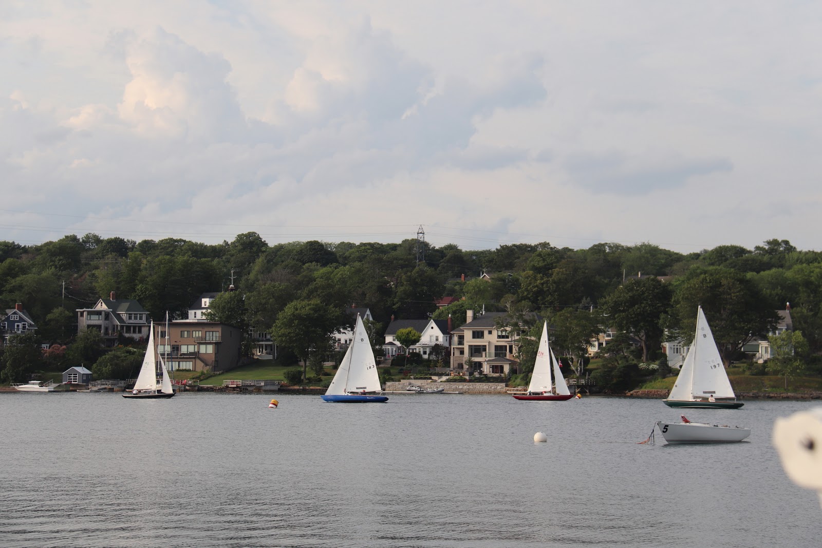
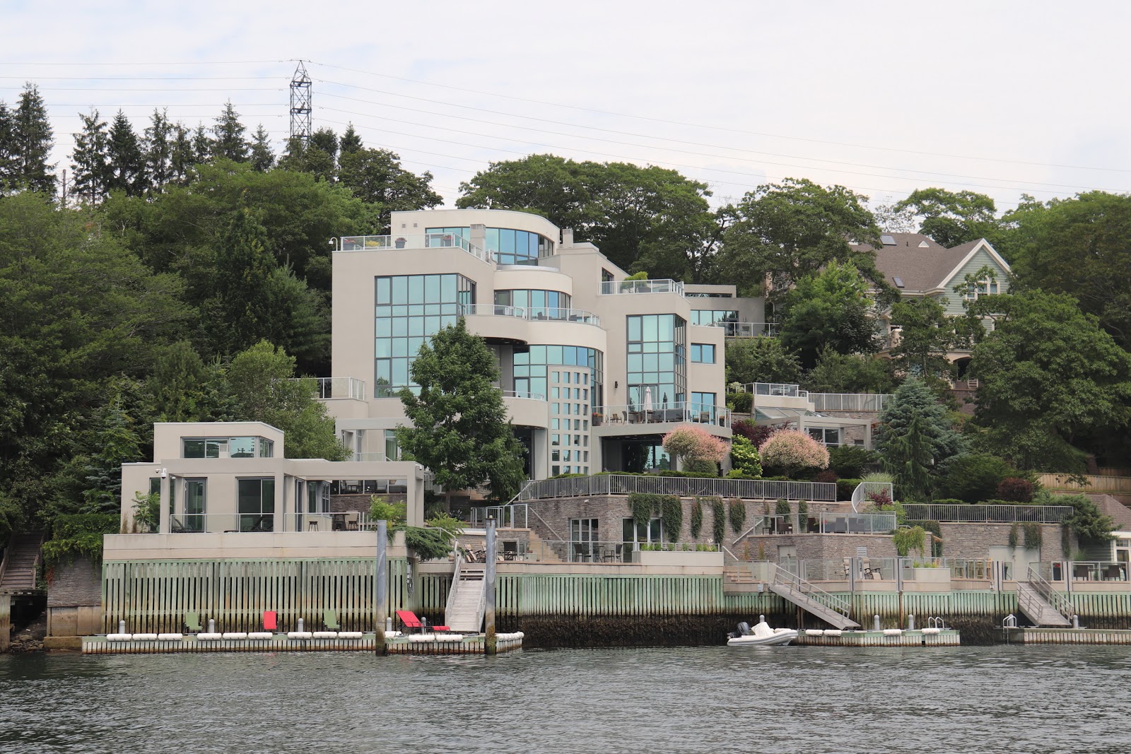
The reason Halifax became historically central and such a pivotal place was due to it's deep and protected harbour.  For us pleasure craft, the protection is certainly nice, but it does mean that we had about 7 miles to go before we found ourselves at the Armdale Yacht Club where we would speed the next few nights.  The journey up the "arm" was not without interesting things to look at.   Old decaying WWII fortifications, opulent homes, R.N.S.Y.S, fleets of wooden bluenose sailboats (still very actively raced around here), sailing school fleets, rowers, and much more.

Home or resort/hotel,
often hard to distinguish
We found A.Y.C. a nice place to be, and thoroughly unique in it's own right.  Located on tiny Meleville Island (similarly named to the shoal off Kingston), and accessible via a man made causeway. 
The docks radiate out like spokes on a wheel from the island, all the way around.  The clubhouse was a former wardens house from when there was a prison on the island.  The prison building still exists and the club uses as locker storage, each member getting a "cell" to keep their stuff in.

Bluenose fleet racing in the narrow
channel.  Most of them wooden
The site has had a long list of other uses in the past from being a family estate, hospital, quarantine station, military prison, prisoner of war camp, recruit training station for the British Foreign Legion and ammunition depot.  The place has a similar feel to KYC, comfortable, and casual, and a unique location.

Halifax welcomed our first night there with a fantastic electrical storm.   Here we would enjoy a few days, see some sights, have Debbie re-join the crew, do some repairs, and relax a little before continuing our trek west to explore the rest of Nova Scotia.

First night in Halifax.   What a show!