

|
Tor Bay to Halifax Current Location: Armdale Yacht Club Date: July 26 to August 1 Mile: 1520 - 1651 Locate: Ramble On Locate: Finnish Line 2.0 Google Photo Albums: Tor Bay Hartlings Island Shelter Cove Jeddor Harbour |
 From our departure form the Bras d'Ore Lakes until we get to Halifax will require almost 200 nm of sailing with much of it along coastline that is rugged and has relatively few harbours for recreational boats. In fact, we planned to anchor our each night until we reached Halifax. Our final departure point from Nova Scotia will be Yarmouth or perhaps Clarks Harbour, and that will be almost 400 nm of sailing.
 |
| Large boulder inside Tor Bay |
Tor Bay
 |
| Berry Head light and breaking swells |
As we approached Tor Bay we began to get a reprieve from the swells as we gained protection from Berry Head. We arrived a little while after Bob and he had already pulled right up to the south shore of the bay, just inside the point, and dropped anchor. We proceeded to pull up beside and raft.
 |
| Nasty shoal! |
The anchorage was flat calm, but you could still hear the breaking swells from the point and the other side of the head. The ocean rarely sleeps even when the winds die.
Hartlings Island
 Our next stopover on the eastern shore was another 50 nm away. We have been scouring the charts and the ActiveCaptian resources along this shore to locate anchorages. While there may be 1000's of places to hide out and drop an anchor but seeing a location marked with an anchorage or having a review confirming good holding gives you peace of mind. The shores here are rocky, and unforgiving.
  |
| Hard to see but ... Tuna fin in lower right of picture |
Later in the afternoon at two different times we saw sea turtles go past the boat. They surface for just long enough for you to go and get your camera, but not long enough to get an actual picture of them.
Our destination was an anchorage tucked in behind Hartlings Island near Ecum Secum (competing for best place name we've found).
The anchorage was as described. We were well protected from any ocean swell, and had limited fetch on all sides. There was some tin boat traffic from local fishermen, and an abandoned cottage on the island, but otherwise it was just a seal or two to keep us company as well as a curious seagull that swam around just a few feet from the boats for quite a while perhaps hoping for a food scrap which we didn't provide.
In the morning, we awoke to varying thicknesses of fog, and as times we could barely see any of the land masses that surrounded us. The fog often comes and goes, thins and thickens, sometimes you can see blue sky if you look up. We decided to hold tight at this anchorage for another day to see if the fog would clear up for a morning departure the following day.
 |
| Morning fog behind Hartlings Island |
Eventually, while still hazy, we could see a comfortable mile or so in all directions, so we made the call to lift anchor and get ourselves underway.
Shelter Cover

Today provided a taste of what was to come along our journey along the south side of Nova Scotia. No sooner that had we gone a few miles, the fog filled back in and filled in thick. It varied little all day except when, at times, you could see 200' ahead, but most of the time barely more than 100'.
Our destination for the night was an appropriately named place called Shelter Cove. Our route would take us through a minefield of shoals, rocks and tiny islands.
 |
| Landforms only barely visible |
 |
| Most of the time we couldn't see Finnish Line at all |
All of this requires double checking routes and waypoints, and cross referencing the chart plotter charts with the Navionics charts to be sure they are in reasonable agreement. You still need to do your homework and double check everything, at every zoom level!!! (remember Vestus)
Today there would be no sailing. There wasn't much wind, but
 |
| Typical navigation between shoals and islands |
 |
| Finnish Line to windward |
 We crept our way into Shelter Cover. The entrance was only 300' feet wide, and the length of the cove was probably not more than 800' long. We had a few of these narrow channels to navigate today, so away from the wind and swell, this was no longer a navigational challenge. Now if we had relied on paper or electronic charts alone we probably would not have entered this cove. The charts all reported just a few feet of depth to get in. One of the very helpful additions to the electronic charting products you have now is crowd sourced reviews. We have relied on ActiveCapitan reviews for many of our anchorages and decision making on this trip. There was a recent posting that the depth into Shelter over was 20+ feet and that the charts were not accurate. We did proceed very slowly into the cove, but we didn't see less that about 22 feet.
 |
| Always checking you out ... but rarely caring |
While we never did see much of the cove, we did have the company of a young seal that spent lots of time swimming and fishing near us. At one point I saw him playing with a fish he had caught by tossing it up in the air.
Jeddore Harbour (Myers Point)
 |
| Marks only become visible when they're 100' away |
 Fresh off a few days of fog navigation, we didn't hesitate in departing in the fog from Shelter Cove. We continued to exercise caution in route planning and navigation. Again we were blessed with a day of complete fog that followed us until we were at the mouth of Jeddore Harbour were the shoreline, houses, and other features began to appear in a sunny haze.
 |
| This was the first real signing of land for the whole day |
 |
| Fog had lifted further in the harbour |
Halifax
 Now, throughout these fog bound legs, Bob was keeping his eyes on his radar. A couple of times he radioed to let me know about things I couldn't see. Many boats have AIS, but fishing boats, at least the smaller ones, do not, and other recreational boats may or may not have it. Radar sees everything else.
At one point Bob was tracking a boat on radar that was approaching his course or position, so he altered speed and course to avoid. Bob communicated this to us via VHF so we'd understand what his otherwise erratic course was all about. Even with all his efforts, the other vessel still had concerns and eventually called out on the radio to "Finnish Line" and after a little communication the fishing boat said "Can't you see me, I'm right behind you!" Bob looked over his shoulder to his aft to find a fishing boat hauling traps!
 |
| leaving the fog behind and turning to head into Halifax |
 |
| Freighter disappearing into the fog |
We watched a freighter depart the harbour heading south west. After they dropped their pilot back on the pilot boat, they carried on and disappeared into the fog. Interestingly, the last thing we saw of the freighter was the bridge superstructure which was taller than the fog bank. What a view the bridge crew would have from such a vantage point.
 |
| Minke whale in Halifax harbour |
 |
| Still an active commercial port |
 |
| Old WWII fortification? |
 |
| R.N.S.Y.S. (we left them a deposit when we left Halifax!) |
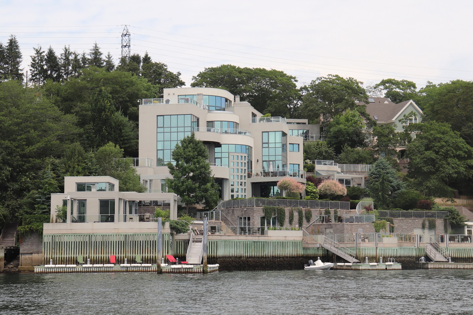 |
| Home or resort/hotel, often hard to distinguish |
The docks radiate out like spokes on a wheel from the island, all the way around. The clubhouse was a former wardens house from when there was a prison on the island. The prison building still exists and the club uses as locker storage, each member getting a "cell" to keep their stuff in.
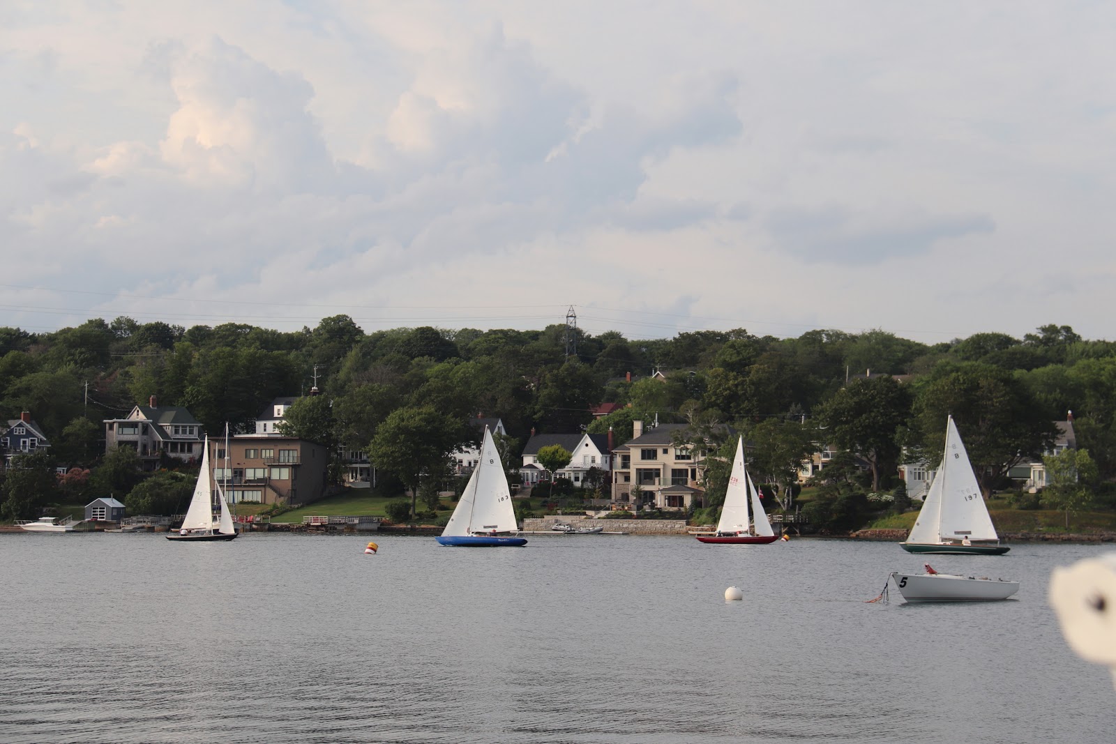 |
| Bluenose fleet racing in the narrow channel. Most of them wooden |
Halifax welcomed our first night there with a fantastic electrical storm. Here we would enjoy a few days, see some sights, have Debbie re-join the crew, do some repairs, and relax a little before continuing our trek west to explore the rest of Nova Scotia.
 |
| First night in Halifax. What a show! |
No comments:
Post a Comment