|
Bras d'Or Lakes & Cape Breton Current Location: St Peters's Marina Date: July 17-26 Mile: 1364-1473 Locate: Ramble On Locate: Finnish Line 2.0 Google Photo Albums: St Peter's, Crammond Islands, Beaver Island, St Peter's, Baddeck, Cape Breton Driving Tour, Ben Eoin & Louisbourg, St Peter's |
For any who don't know (I didn't really know much before planning for this trip), the Bras d'Ore Lake (often called Lakes) is an inland salt water lake on Cape Breton that is connected to the outside via two natural channels on the north east, and by the man made St. Peter's canal that enters from the Strait of Canso at the south-west (this is how we arrived and departed).
It is a beautiful escape to a cruising ground that is protected from ocean swell and has may islands to explore and anchor at. Similar to the Thousand Islands in that there are secluded anchorages everywhere, but different in that there is good sailing to get to each anchorage. It's not hard to find a nice 15-30 nm sail to get to your next anchorage.
Some scheduling issues meant that we had a few days with Bob, Tarja, Chris M., Linda and I before Tarja had to drop Chris M. off and Shediac (where he had left his car when he joined the expedition) and pick up Ben who was flying into Moncton (many thanks to Tarja for being such a trooper doing so much driving). This meant a few days cruising and then back to St. Peter's for an exchange of crew.
As an extra bonus, we had plans to meet with friends and fellow KYC'ers, Peter and Ze, and they had a wedding to attend in Nova Scotia, and were going to treat us to a few days of driving and exploring Cape Breton, where Ze grew up!
St. Peter's
 |
| Teamwork? |
 |
| Locking through |
The sail on the outside of Ile Madam was nice and the winds were cooperative.
Crammond Islands
 |
| Small wharf and old building from a time gone by |
 |
| Marble Mountain? |
 |
| Windy out there, nice in here! |
From there, we continued a few more miles to find our anchorage tucked between the Crammond Islands. It will breezy all night, but we were well protected and had a nice evening. Chris hopped in Bob's inflatable kayak and explored the area.
Beaver Island
 Since we had to get Tarja back to St. Peter's Marina first thing the next morning, this anchorage needed to be close by. For this we chose to anchor behind Beaver Island.
It was a flat calm evening and very pleasant. Linda and I dropped the dinghy down and did an evening explore around the island. We saw several jumping fish, likely targeting the many insects at dusk.
Back to St Peter's
 |
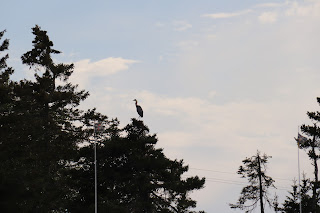
| Heron with the best view! |
The local bakery was open and Linda was delighted to discover it made the baked goods in the authentic German style. They even had "Bienenstich" pastry, one of Linda's dad's favourites.
 |
| Jetski, dock whips!! abomination |
Tarja and Ben arrived back at St Peters around 7pm, and Linda had our boat-made lobster Mac and Cheese with Bacon waiting for them (made with lobster we had purchased along the way, perhaps in Escuminac)
Baddeck
With the crew exchange complete and Ben on board, we left St Peter's the next morning headed for Baddeck. The weather was lovely and we had enough wind for a close reach. Ben sailed on Ramble On with me, and Linda sailed with Bob on Finnish Line so he wouldn't have to solo it. Tarja drove and met us at the dock in Baddeck.
 |
| Finnish Line clearing the Barra Strait bridge |
 |
| Protected harbour with mooring field |
'
 There is an iconic lighthouse at the point, yachts of all shapes and sizes at mooring balls, a large wharf with a tall ship so tourists can go for a day sail, and to top it off, a local resident playing bagpipes (we later found out that he not only plays at the wharf, but walks the streets of the town, playing all the way)!
 |
| Ramble On @ Baddeck Marine |
 |
| So cool, want one! |
 |
| Kidston Isl Light |
Another highlight of being in Baddeck was heading to the Alexander Graham Bell Museum and taking some time to learn more about his time and continuing inventiveness while living in Baddeck. He spent much time working on hydroplanes, kites and airplanes. There was a full reproduction hydroplane (the "HD-4") as well as portions of the original that had been sitting on the beach at his Beinn Bhreagh estate from the early 1900's after the tests where completed until much later. The Canadian Navy built an experimental hydrofoil submarine hunter (1968-1971) named the Bras d'Ore as a nod to Mr. Bell!
 |
| Beinn Bhreagh (hard to see) |
Cape Breton Exploration by Car
 Over the next few days we were going to get a personalized tour of Cape Breton from the point of view of a local (Ze), but first we had a boat pizza night with the who gang on Ramble On. We've done this a few times, and it's been a real treat. Dough made on the boat, local seafood toppings (bought next door to the marina from Captain Caper's Fish & Chips) as well as other gourmet pizza varieties. Having the round "kettle" style BBQ work well for this, but it is a "one at a time" affair so a different pizza slice arrived about every 10 minutes!
  |
| Following our intrepid leader! |
 |
| Avoid the one on the left! |
 The tasting was interesting as it started with an unaged whiskey, strait from the still. This stuff was awful and in my mind tainted the rest of the tastings. It was only after abandoning any hope of finishing that first sample, and letting it's taste fade away that some of the others began to show some promise. In the end, I picked up a bottle of the "Battle of the Glen". So named for the nearly 10 year legal battle with the Scotish Whisky Association that argued that they weren't allow to have "Glen" in the name.
 |
| Feet in the water at Inverness |
From there we continued our driving tour, stopping a scenic lookouts and various placed along the way while passing by or through places like Maragaree Harbour, Grand Étang, Cheticamp and Petit Étang until we formally entered Highlands National Park.
Skyline Trail


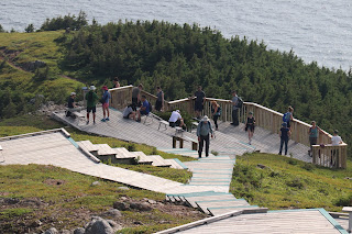
 The scenery along this shore became steadily more dramatic as we progressed. The shoreline cliffs and geology became progressively taller and more beautiful. The focal point of the day was our stop for a hike on the Skyline Trail. This was a 5 km hike through scrubby and and stunted forests but with the terminus at the most spectacular peninsula with a vista with few equals.
Pleasant Bay
That evening, with everyone a little tired, we found our destination for the night. This was the "pinkest" hotel around called the Midtrail Motel & Restaurant located just at north edge of Highland National Park in Pleasant Bay. We ate at the hotel restaurant, and conked out in our rooms for a well deserved sleep.
 The next day we continued our exploration of the north-east end of Cape Breton passing though places like Meat Cove, Aspy Bay, Dingwall, then back down into the park area to Ingonish.
 |
| Visitor keeping distance from corpse |
 Along the way we stopped at Cabot Landing Provincial Park. A small park with a nice beach.
Of a personal note, Ze's grandfather had made some of the bronze plaques on display at the park. It is thought that John Cabot may have landed in this vicinity. We enjoyed stretching our legs here with a short walk along the beach.
Ingonish
 Our plan was to head to the Keltic Lodge for a hike along the "Middle Head" hiking trail, but first we passed our lodging for the night so we stopped at the Driftwood Lodge to get ourselves checked in. A quaint place right along the shoreline with a slightly hippie feel about it. We could see the Keltic Lodge across North Ingonish Bay. This is where we were heading next.
Middle Head Trail
 |
| Don't ... be Superman? |
 To get to the trail, you enter the Keltic Lodge grounds and continue past the various posh resort buildings until you get to the beginning of the trail. This trail spent a good amount of time going through wooded areas with rough rocky and rooty paths. As it progressed, and we worked out way further out and up on the peninsula the woods began to clear and we could see the rocky shoreline on each side. Again, the end of the trail was marked by spectacular views in all directions looking down on the rough Cape Breton shoreline.
 |
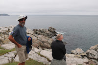
| Soaking in the view |
 We departed the Keltic Lodge site and headed back to scout for someplace to eat. Along the was stopped for some shopping. After some asking we identified our place to eat (where the locals go) and we had hearty servings of seafood! After that, we drove back around the bay again, but this time we were going into the Keltic Lodge to listen to some music. A guitarist and local fiddler put on a great show that had everybody tapping their feet at one point or another.
Back to Baddeck and to Ben Eoin
 |
| clubhouse |
This will be the eastern most point in our adventure. We hit the northern most point going along the Gaspe peninsula (440nm west and 300nm north of Kingston), and Ben Eoin represents about 700nm east and 100nm north of Kingston. New York will be the most southerly point, and Oswego will be the most westerly point. This point also represents about 1400nm (2600km) of distance traveled. This is just over half way in mileage and in day.
 |
| Ben Eoin Harbour |
We made plans with Rick and Laura to informally meet up at Louisbourg Fortress historic site the next day.
Louisbourg Fortress
 |
| Sea facing entrance gate |
The next day, after about an hour drive, we arrived at the fortress entrance and parking area. This was my first time here, and it is an impressive site. The current building were re-built from barely more than rubble in the 60's and 70's putting the unemployed coal miners to work. The scale of the building project in hard to fathom. The King's Bastion itself is a massive building that must be a 1000' long. Let alone the rest of the small city that has been reproduced.
 We had an enjoyable day wandering the village, looking at the various snapshots back in time, talking to the period dressed staff (who spoke and played their period part when they interacted with you).
 |
| The Kings Bastion |
We bought some locally made bread and ate lunch in the peasants restaurant which fed you authentic food for the period in a building with tables and table ware appropriate to the time.
 |
| Preparing to fire! |
 |
| Very much looking the part |
We returned to the marina after bidding Rick and Laura adieu and good travels in their camping expedition. Everyone was a little tired and sun baked. The next day we would be heading back to St. Peter's Marine for our last night in the Bras d'Ore Lakes before heading back out through the canal to continue our journey westward along the eastern shore of Nov Scotia.
 |
| Obediently lined up to enter |
 |
| Single file only |
Locking through was easy and calm as it was when we entered.
Off we go towards Halifax and beyond.


No comments:
Post a Comment